| File:UK Hydrographic Office logo.png | |
 Headquarters building | |
| Agency overview | |
|---|---|
| Formed | 1795 |
| Headquarters | Taunton, Somerset |
| Employees | approx 1000 |
| Minister responsible |
|
| Agency executives |
|
| Parent agency | Ministry of Defence |
| Website | http://www.ukho.gov.uk/ |
The United Kingdom Hydrographic Office (or UKHO) is an organisation within the UK government responsible for providing navigational and other hydrographic information for national, civil and defence requirements. The UKHO is located in Taunton, Somerset on Admiralty Way and has a workforce of approximately 1000 staff.
The office is an Executive Agency, and trading fund, of the Ministry of Defence and is directly responsible to the Minister for Defence Personnel, Welfare & Veterans. The current minister is Mark Francois, MP. The Chief Executive of the agency is Ian Moncrieff, BA, CBE who took over in October 2011. The agency is self-funding and its trading fund status allows protection of the copyright in its publications.
Rear-Admiral Tom Karsten is the current UK National Hydrographer and Deputy Chief Executive (Hydrography). He took up the post in December 2012.
The UK Hydrographic Office has been charting the world’s oceans for more than 200 years with the primary aim of providing navigational products and services for the Royal Navy and merchant mariners to save and protect lives at sea. In addition it serves small craft and leisure mariners and provides a range of consultancy services. UKHO also plays a central role, in support of the Maritime and Coastguard Agency, in discharging the navigation element of the UK’s Safety of Life at Sea Treaty obligations for waters of UK national responsibility.
The office produces a worldwide series of some 3,300 paper nautical charts, 160 publications under the ADMIRALTY brand and Electronic Navigational Charts (ENCs). The ADMIRALTY portfolio is sold globally and used by nearly 70% of international shipping. The UKHO launched the Admiralty Vector Chart Series in April 2008 and the e-Navigator Service in 2009, which brings together all of the information needed for safe navigation, voyage planning and efficient fleet management in one place.
History[]
Establishment and early operation[]
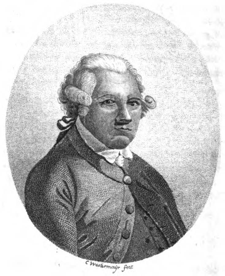
Alexander Dalrymple, engraving by Conrad Westermayr.
The Admiralty's first Hydrographer was Alexander Dalrymple,[1] appointed in 1795 on the order of King George III and in the next year the existing charts were brought together and catalogued. The first chart the Admiralty produced (of Quiberon Bay in Brittany) did not appear until 1800.[2]
Dalrymple was succeeded on his death in 1808 by Captain Thomas Hurd, under whose stewardship the department was given permission to sell charts to the public.[3]
In 1819 Captain Hurd entered into a bi-lateral agreement with Denmark to exchange charts and publications covering areas of mutual interest. This is thought to be the earliest arrangement for the mutual supply of information between the British and any foreign Hydrographic Office.[4] Hurd oversaw the first production of "Sailing Directions" in 1829 and the first catalogue in 1825 with 736 charts. Rear-Admiral Sir W. Edward Parry was appointed Hydrographer in 1823 after his second expedition to discover a Northwest Passage.[5][6]
Explorations[]
In 1828 Captain Parry and the Royal Society organised a scientific voyage to the South Atlantic, in collaboration with the Hydrographers of France and Spain, using HMS Chanticleer.[7]
In 1829, at the age of 55, Rear-Admiral Sir Francis Beaufort became Hydrographer. During this time, he developed his eponymous Scale and saw the introduction of official tide tables in 1833 and the first "Notice to mariners" in 1834. During this period various expeditions took place. Several of these were by the HMS Beagle which went to Tierra del Fuego and Patagonia in 1826. In 1831 Captain Beaufort informed Captain FitzRoy that he has found a savant for the latter’s surveying voyage to South America, Charles Darwin. After completing extensive surveys in South America she returned via New Zealand and Australia, to Falmouth, Cornwall, in 1836.[8] By the time of Beaufort's retirement in 1855, the Chart Catalogue listed 1,981 charts and 64,000 copies of them had been issued to the Royal Navy.[9]
In the 1870s the Hydrographic Service supported the Challenger expedition which was a scientific exercise that made many discoveries to lay the foundation of oceanography. The expedition was named after the mother vessel, HMS Challenger. On her 68,890-nautical-mile (127,580 km) journey circumnavigating the globe,[10] 492 deep sea soundings, 133 bottom dredges, 151 open water trawls and 263 serial water temperature observations were taken.[11] The Challenger crew used a methods that were developed in prior small-scale expeditions to make observations. To measure depth, the challenger crew would lower a line with a weight attached to it until it reached the sea floor. The line was marked in 25 fathom intervals with flags denoting depth. Because of this, the depth measurements from the Challenger were at best accurate to 25 fathoms, or approximately 45 metres (148 ft). As the first true oceanographic cruise, the Challenger expedition laid the groundwork for an entire academic and research discipline.[12]
During the later half of the 19th century the UKHO took part in several international conferences including the International Meridian Conference to determine a prime meridian for international use and others working towards the establishment of a permanent international commission concerning hydrographic matters. Hydrographers to the Admiralty Board during this period included: Rear-Admiral John Washington, Rear-Admiral George Henry Richards, Captain Sir Frederick J O Evans and Rear-Admiral Sir William J L Wharton.
20th century[]

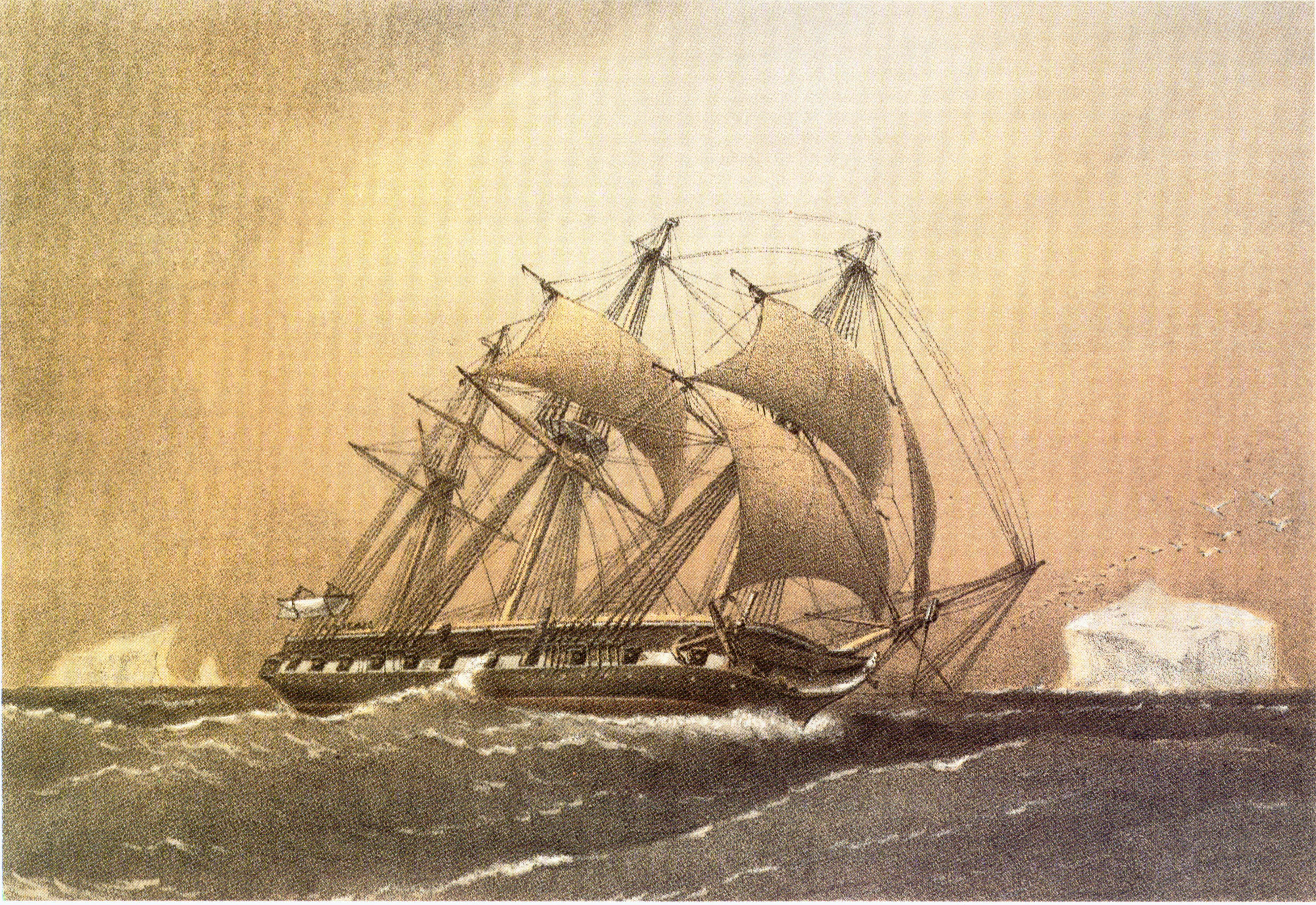
The expedition's ship Nimrod departing for the South Pole
While Rear-Admiral A Mostyn Field was the Hydrographer to the Admiralty Board the Hydrographic Office lent instruments to the Nimrod Expedition of the British Antarctic Expedition led by Ernest Shackleton in 1907. Following the RMS Titanic in 1912 the Safety of Life at Sea (SOLAS) convention was established, as well as the introduction of ice reporting and forecasting. During World War I, while Rear-Admiral Sir John F Parry was Hydrographer of the Navy, the Hydrographic Office produced numerous new charts and products to support the Royal Navy.
Following the war the First International Hydrographic Conference was held in London. It lead to the 1921 establishment of the International Hydrographic Organization. In the 1930s the collection of oceanographic and naval meteorological data started. At the start of the Second World War, while led by Vice-Admiral Sir John A Edgell, chart printing moved to Creechbarrow House in Taunton but the main office did not move until 1968 when compilation staff transferred from Cricklewood to Taunton bringing together the main elements of the Hydrographic Office. A purpose-built office, named after Alexander Dalrymple, was opened. Metrication and computerisation of charts began in the later 1960s and early 1970s under the leadership of Rear-Admiral Sir Edmund G Irving (1960 –1966), Rear-Admiral George Stephen Ritchie (1966 -1971), Rear-Admiral Geoffrey P D Hall (1971 –1975) and Rear-Admiral Sir David W Haslam (1975 –1985).
Originally data was mainly collected using ordinary Royal Navy ships. In 1953, the first purpose-built survey vessel was launched; HMS Vidal.[13] The use of the echo sounder and other electronic equipment in the 20th century saw a big increase in the quantity and quality of the data collected. The technology used to collect data also improved with the first commercial use of multibeam survey technology in 1977 with HMS Bulldog undertaking the first Side-scan sonar of Mounts Bay, Cornwall in 1987. The work has since been continued by the Bulldog-class survey vessels which form the "Hydrographic Squadron".
In 1994 the Hydrographer of the Navy also became the Chief Executive of UKHO and the post was held by Rear-Admiral Nigel R Essenhigh, (1994 –1996) and Rear-Admiral John P Clarke (1996 –2001).
Current developments[]


An example of an Electronic navigational chart (NOAA)
Admiralty Raster Chart Service for the Electronic Chart Display and Information System began to be produced in 1996 and in 2000 online services were started. In April 2008 the UKHO launched its AVCS (Admiralty Vector Chart Service) which aims to get round the inability of many smaller hydrographic offices to produce electronic charts by incorporating them into the Admiralty service.
Under the Public Records Act 1958, UKHO became an authorised 'place of deposit' which has given it the responsibility of maintaining its own archive. Its documents date from 1755. Its prime customer is the Royal Navy for which it produces hydrographic, oceanographic and geophysical products and services. The UKHO also produces a range of outputs for the leisure market. It collects tidal information from around the world and publishes the "Admiralty Tide Tables" (in 4 volumes) and provides an online service called "Easytide".
In 2003 the first recorded use of LIDAR to correct Admiralty charts took place on the west coast of Scotland. In 2008 the Admiralty Vector Chart Service (AVCS) was launched and followed in 2009 by the e-Navigator Service. In 2013 a Print On Demand (POD) service went goes live with distributors.
The Chief Executives in the 21st century were: Dr. Wynford Williams (2001 –2006), Mr Mike Robinson (2006 –2011) and Rear Admiral (Ret) Ian Moncrieff CBE, from October 2011 to the present.
Publications[]
Admiralty List of Lights & Fog Signals vol. H: Northern and Eastern Coasts of Canada
Most UKHO publications are available in both paper and online versions. Publications include charts, nautical publications and astronomical publications. Notable nautical publications include Admiralty Sailing Directions (Pilots, 74 volumes), Admiralty Tide Tables (4 volumes), Admiralty List of Radio Signals (6 volumes), Admiralty List of Lights and Fog Signals (10 volumes) and more. Notable astronomical publications include The Nautical Almanac and The Astronomical Almanac among others.[14]
Access to data[]
As with the Ordnance Survey for land mapping, the UK Hydrographic Office is the part of government with responsibility for charting the seas. It is part of the Ministry of Defence and operates as a Trading Fund, enabling it to be self-funding through sale of products and licensing of data. These issues are very different to those of the Ordnance Survey where data is gathered at public expense: the UKHO sources much of its information from foreign governments to whom it pays royalty fees funded by the profits it makes.
The UKHO has six different licences, according to the use of the product. Whilst it generally allows use for non-navigational, non-commercial or low value purposes free of charge (over 80% of licences), where licensing is for use in a commercial product, a licence fee is charged. The UKHO is committed to the Information Fair Traders Scheme[15] and makes available for re-use those data that are collected as part of its Public Task,[16] which do not include third party Intellectual Property Rights.
In the Information Fair Trader Scheme Report on the UKHO in April 2011[17] it states that the UKHO data will not be included in the Public Data Corporation to make government owned data more freely available, but it does recommend that the “UKHO should consider the introduction of a Free Navigational Licence" for non-commercial or low value use, consistent with its treatment of non-navigational use.
See also[]
- Admiralty chart
References[]
- ↑ "Dalrymple, Alexander (1737–1808)". Australian Dictionary of National Biography. http://adb.anu.edu.au/biography/dalrymple-alexander-1949. Retrieved 12 January 2014.
- ↑ "British Admiralty". Geographicus. http://www.geographicus.com/mm5/merchant.mvc?Screen=CAD&Product_Code=admiralty. Retrieved 12 January 2014.
- ↑ Hardisty, Jack (2008). Estuaries: Monitoring and Modeling the Physical System. John Wiley & Sons. pp. 41–42. ISBN 9781405172325. http://books.google.com/?id=ep_tRRGWniQC&pg=PA41&lpg=PA41&dq=Admiralty+chart+Quiberon+Bay+1800#v=onepage&q=Admiralty%20chart%20Quiberon%20Bay%201800&f=false.
- ↑ Webb, Adrian (November 2010). "Foundations for "International cooperation in the field of hydrography": some Contributions by British Admiralty Hydrographers, 1795-1855" (PDF). pp. 7–15. http://www.iho.int/mtg_docs/IHReview/2010/IHB_Review_finalNov10.pdf.
- ↑ Webb, Adrian. "The Expansion of British Naval Hydrographic Administration, 1808-1829" (PDF). PhD Thesis. University of Exeter. https://ore.exeter.ac.uk/repository/bitstream/handle/10036/116990/WebbA_fm.pdf?sequence=3. Retrieved 12 January 2014.
- ↑ J.C. Sainty (1975). "Hydrographer 1795-1870". Office-Holders in Modern Britain: Volume 4: Admiralty Officials 1660-1870. Institute of Historical Research. http://www.british-history.ac.uk/report.aspx?compid=16686. Retrieved 12 January 2014.
- ↑ "NMM, vessel ID 382156" (PDF). Warship Histories, vol v. National Maritime Museum. http://www.nmm.ac.uk/upload/pdf/Warship_Histories_Vessels_v.pdf. Retrieved 12 January 2014.
- ↑ "FitzRoy, R. 1839. Narrative of the surveying voyages of His Majesty's Ships Adventure and Beagle between the years 1826 and 1836, describing their examination of the southern shores of South America, and the Beagle's circumnavigation of the globe. Proceedings of the second expedition, 1831-36, under the command of Captain Robert Fitz-Roy, R.N. London: Henry Colburn.". Darwin Online. http://darwin-online.org.uk/content/frameset?viewtype=text&itemID=F10.2&pageseq=757. Retrieved 12 January 2014.
- ↑ "Charting the world for over 200 years". www.ukho.gov.uk. UKHO. http://www.ukho.gov.uk/corp/History.asp. Retrieved 15 November 2006.
- ↑ Rice, A.L. (1999). "The Challenger Expedition". Understanding the Oceans: Marine Science in the Wake of HMS Challenger. Routledge. pp. 27–48. ISBN 978-1-85728-705-9. http://books.google.co.uk/books?id=F5agn3NSzEoC&pg=PA27.
- ↑ Oceanography: an introduction to the marine environment (Peter K. Weyl, 1970), p.49
- ↑ "Then and Now: The HMS Challenger Expedition and the 'Mountains in the Sea' Expedition". Ocean Explorer. http://oceanexplorer.noaa.gov/explorations/03mountains/background/challenger/challenger.html. Retrieved 12 January 2014.
- ↑ "Timeline of the UKHO" (PDF). www.ukho.gov.uk. UKHO. Archived from the original on 29 March 2007. http://web.archive.org/web/20070329154923/http://www.ukho.gov.uk/content/corpAttachments/Time+Line+Panel_1.pdf. Retrieved 15 November 2006.
- ↑ "Products and Services". United Kingdom Hydrographic Office. http://www.ukho.gov.uk/PRODUCTSANDSERVICES/Pages/Home.aspx. Retrieved 25 July 2010.
- ↑ "Information Fair Traders Scheme" (PDF). UKHO. https://www.ukho.gov.uk/copyright/docs/fair%20trading%20info.pdf. Retrieved 12 January 2014.
- ↑ "Public Task" (PDF). UKHO. http://www.ukho.gov.uk/AboutUs/Documents/UKHO-Public-Task.pdf. Retrieved 12 January 2014.
- ↑ "Information Fair Trader Scheme Report on the UKHO" (PDF). National Archives. http://www.nationalarchives.gov.uk/documents/information-management/ukho-ifts-report-2011.pdf. Retrieved 12 January 2014.
External links[]
- The official UKHO web site The United Kingdom Hydrographic Office
- The official Admiralty web site Admiralty products and services from the UKHO
- Admiralty Easytide, Admiralty's online tidal prediction service
| ||||||||||||||||||||||||||||||||||
The original article can be found at United Kingdom Hydrographic Office and the edit history here.